
Coast Survey to improve "magenta line" on Intracoastal Waterway nautical charts
The Office of Coast Survey announced today that future editions of nautical charts of the Intracoastal Waterway will be updated to include an improved "magenta line" that has historically aided navigation down the East Coast and around the Gulf Coast. Additionally, Coast Survey will change the magenta line's function, from the perceived "recommended route" established more than a hundred years ago, to an advisory directional guide that helps prevent boaters from going astray in the maze of channels that comprise the route.
The decision comes on the heels of a year's investigation into problems with the magenta line. In early 2013, after receiving reports of groundings by boaters who followed the line into shoals, Coast Survey started to remove the magenta line from Intracoastal Waterway nautical charts.
"We cannot deliberately include chart features that we know may pose a danger to navigation," explained Rear Admiral Gerd Glang, director of Coast Survey. "The problems of the magenta line's misplacement, which had been developing over the past seven decades, were aggravated when some boaters assumed that the line indicated a precise route through safe water - although it actually went over land, shoals, or obstructions."
The U.S. Coast and Geodetic Survey, a NOAA predecessor agency, first installed the line on nautical charts in 1912, when the advent of motor boating produced a demand for charts of the inland waters and shallower waters along the East Coast. The magenta line on Intracoastal Waterway charts received major updates in 1935, thanks to an influx of funding from the Great Depression's Public Works Administration. Charts rarely recorded updates of the magenta line in the ensuing 70 years.
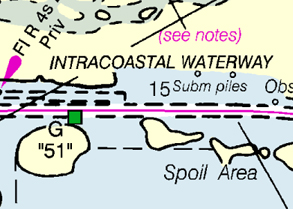
Intracoastal Waterway Nautical Charts
Boating public wants directional guidance
In 2013, while Coast Survey cartographers were removing poorly placed lines from charts that were undergoing regularly scheduled updates, Glang ordered a cartographic review of the magenta line's function and maintenance. Simultaneous with an internal review of the issues, Glang issued a Federal Register Notice asking for public comments. Almost 240 individuals and organizations offered comments, saying that the line helped safe navigation on the Intracoastal Waterway.
"We asked Intracoastal Waterway users to let us know if they need the route designated on nautical charts, and the response was 99.9 percent in favor of keeping it on charts," Glang said. "Many of the commenters explained how the magenta line saved them from dangerous or costly navigation errors. They also confirmed that we need to clear up any misunderstanding about what the magenta line is - and what it isn't."
The internal review and public comments confirm that the magenta line needs to be removed where it poses a danger to navigation, rebuilt to avoid shoals and other dangers, and reinstated to all the Intracoastal Waterway nautical charts. Importantly, Coast Survey will add notes to the Intracoastal Waterway charts, emphasizing that vessels transiting the waterway should be aware of changing conditions and always honor aids to navigation.
Improvements will take years to fully implement
"Today's decision to reinstate the magenta line is not a quick fix," cautions Captain Shep Smith, chief of Coast Survey's Marine Chart Division. "It will take at least three years to fix problems that were 70 years in the making."
Of Coast Survey's 1052 nautical charts, 52 depict the magenta line. As charts are rotated through the update process, Coast Survey will evaluate and update the magenta line using charted information. When no depth soundings are on the chart, the line will generally be positioned in the centerline of dredged channels and natural waterways, avoiding shoals or obstructions less than the controlling depth. When the chart data is insufficient for determining the line's preferred route, Coast Survey will attempt to gather additional data from partner agencies and reliable crowdsourcing.
"Most of the magenta line can be re-drawn by using the charted information, and we hope to get it done by mid-2015," Smith explains. "On the other hand, resolving discrepancies between charted information and the line will require research, and new data acquisition and processing, with support from other federal agencies."
Resolving chart discrepancies is a longer-term challenge, Smith says, and can conceivably take up to five years, or even longer. In cases where information is lacking and the line depiction can lead to risky navigation, Coast Survey will remove the line.
Coast Survey to increase use of boater reports for Intracoastal Waterway chart analysis
Access to more info through ActiveCaptain
Today's announced undertaking to improve the "magenta line" on Intracoastal Waterway nautical charts requires a concerted effort to evaluate areas of the charted line that are inaccurate. Coast Survey is now adding ActiveCaptain data to the cartographic toolkit in the chart evaluation system.
"We need to hear from boaters who can provide hazard locations," said Capt. Shep Smith, chief of Coast Survey's Marine Chart Division. "Over 200,000 boaters actively share information on ActiveCaptain, and their reports along the Intracoastal Waterway are particularly helpful for revising the 'magenta line."
Coast Survey and ActiveCaptain recently signed a Terms of Service agreement, giving NOAA access to data that will pinpoint problems as cartographers investigate specific reports of navigation issues.
Traditional reporting systems still in effect
Boaters continue to have a direct line to NOAA for reporting chart errors. The fastest way to notify Coast Survey of dangers to navigation is to submit a chart discrepancy through the Nautical Discrepancy Reporting System. The system asks boaters to identify which chart they are reporting, the time of observation, and the position of the discrepancy.
Coast Survey also has a long-standing "cooperative charting" agreement with the U.S. Power Squadrons, which was renewed in 2013. Under the program, USPS volunteers look for changing conditions on nautical charts and submit their reports directly to Coast Survey. Over the last ten years, volunteers have submitted over 28,000 corrections to NOAA's nautical charts and the U.S. Coast Pilot. More than 4,000 USPS members submitted reports, adding their particular local knowledge to NOAA's national effort to keep navigation materials accurate.
Boaters need to maintain situational awareness
The ActiveCaptain reports, along with information submitted by USPS volunteers and the general boating public, provide essential data for improving the magenta line. Even with the improvements, however, Coast Survey continues to remind boaters that the Intracoastal Waterway changes frequently. Vessels transiting the waterway must remain aware of changing conditions and honor aids to navigation.
TOP
|