Illustrated by Kristen Crossett
2016 IN REVIEW...
It's been a great year, working with mariners, federal partners, navigation product vendors, and the maritime industry! Thank you for your continued commitment to navigation safety.
Reviewing the past year... Commercial pilots and recreational boaters got new charts and important services from NOAA. Here's a brief roundup of some of the news.
*********
New service improves chart updates for navigation systems and apps

Updating digital nautical charts is faster and easier after Coast Survey divided charts into "tiles" that commercial systems can upload for updating the charts they use in their chart plotters, tablets, and mobile devices.
Read more >> About this year's service improvements, enabling chart users to download updates without having to be online.
*********
NOAA issues new nautical chart for the Port of Palm Beach, Florida
The Palm Beach Harbor Pilots Association asked Coast Survey for the new chart, citing the dangers confronting navigators who approach the port and anchor offshore using the small scale coverage and corresponding lack of detail currently available on chart 11466 (1:80,000).
Read more >> About the new 1:15,000 scale chart and 1:5,000 scale inset on new chart 11459.
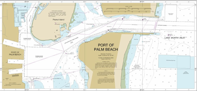
New nautical chart 11459 adds details for Port of Palm Beach
*********
Speeding resumption of commerce after Hurricane Matthew
Matthew became a hurricane on Thursday, September 29, and it was soon clear that Coast Survey's navigation services would be needed for the maritime transportation system's rapid recovery operations, to search for underwater debris and shoaling.
While Hurricane Matthew was still three days away from hitting Haiti, Coast Survey was already ramping up preparations, and when NOAA's National Hurricane Center zeroed in on a major hit to the southeast coast, we began moving personnel and survey vessels for rapid deployment. Our people and equipment were ready to move in and hit the water as soon as weather and ocean conditions allowed.
Read more >> About port recovery assistance in Florida, South Carolina and Georgia.
*********
FINDING DANGERS TO NAVIGATION
Fast chart update of navigation danger protects Georgia boaters
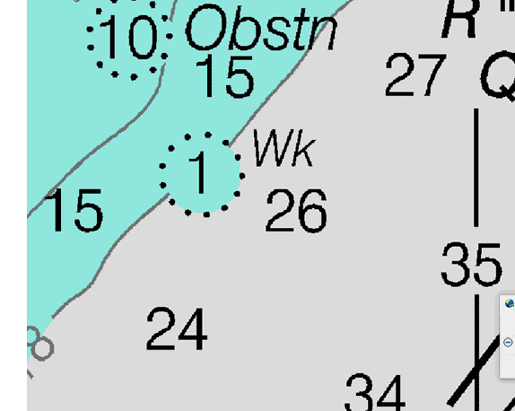 Thanks to a combination of determination and technical advancements, Coast Survey was able to locate, report, and chart a danger to navigation within two weeks - a major improvement over the three-to-ten-year chart update protocol of only a few years ago. Thanks to a combination of determination and technical advancements, Coast Survey was able to locate, report, and chart a danger to navigation within two weeks - a major improvement over the three-to-ten-year chart update protocol of only a few years ago.
Read more >> About the fast action by surveyors and cartographers.
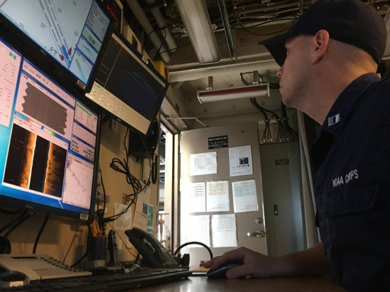
Locating submerged danger in Chesapeake Bay
Combining the efforts of a 3-person response team (using an autonomous underwater vehicle) and the surveyors onboard NOAA Ship Ferdinand Hassler (using a multibeam echo sounder), Coast Survey responded to a request by the U.S. Coast Guard and located a sunken buoy in Thimble Shoal Channel.
Read more >> About how the teams' success enabled the Coast Guard to re-open anchorages in the area.
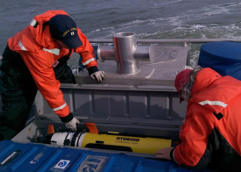
NOAA LT Ryan Wartick and physical scientist Robert Mowery were part of the team who used an AUV to locate five potential targets when searching for a specific wreck.
*********
Evaluating unmanned surface vehicles for surveys
Coast Survey is testing the use of small unmanned surface vehicles (USV) to survey the shoalest depths, areas along the shore where NOAA ships and their launches are unable to reach. These USVs proved beneficial not only for mapping shallow, murky waters, but also for improving the efficiency of our hydrographic operations.
Read more >> about USV operational evaluation by government and private experts.
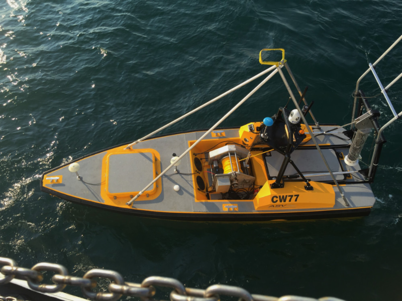
NOAA evaluates the C-Worker 5 USV for surveying
#########################
Contact Details - NOAA Office
#########################
NOAA Office of Coast Survey, 1315 East-West Highway,
SSMC3 #6203, Silver Spring, MD 20906.
888-990-6622.
Mail to: coastsurveycommunications@noaa.gov
Website: www.nauticalcharts.noaa.gov.
Facebook: https://www.facebook.com/NOAAcharts/
Twitter: https://twitter.com/NOAAcharts
TOP
|