Satellite image of New Yorks Finger Lakes
By Evan Kreager
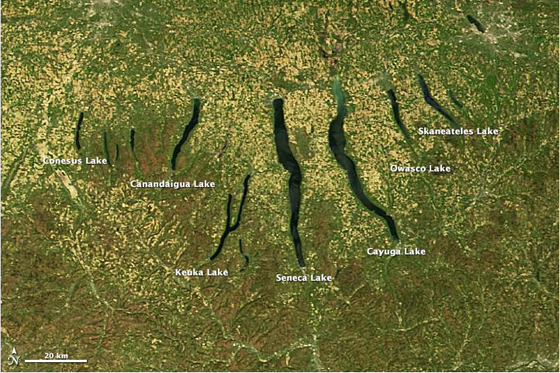
The Finger Lakes in upstate New York were formed around 10,000 years ago
as a result of the last glacial recession. (Image: NASA)
NASAs Terra Satellite captured this image of upstate New Yorks Finger Lakes on May 6, 2013.
Agricultural areas appear a tan color in the picture, wooded areas brown and grass and low-lying vegetation green, according to Adam Voiland at the NASA Earth Observatory.
Millions of years ago the lakes were streams, northward flowing and V-shaped. Over time, as glaciers advanced and retreated, the streams were buried under ice and reshaped.
During the last glacial recession around 10,000 years ago, the glaciers left piles of debris which functioned as dams, turning the streams into lakes.
Among the Finger Lakes are Seneca and Cayuga lakes, two of the deepest lakes in North America.
Credit Great Lakes Echo and link stories to GreatLakesEcho.org. © 2013.
Credit Great Lakes Echo, Michigan State University Knight Center for Environmental Journalism. GreatLakesEcho.org
To submit an image to Great Lakes Echo Photo Friday, send photo, caption and your name to greatlakesecho@gmail.com
TOP
|