|

A Guide Book Primer
by Cyndi Perkins
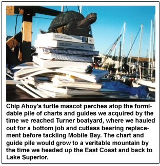 Over the years a glut of charts, guides and reference manuals have been crammed into Chip Ahoy's bookshelves. Whilst sorting through the hodge-podge to eliminate the spacewasters from the useful material it becomes clear that you truly can't judge a book by its cover. Over the years a glut of charts, guides and reference manuals have been crammed into Chip Ahoy's bookshelves. Whilst sorting through the hodge-podge to eliminate the spacewasters from the useful material it becomes clear that you truly can't judge a book by its cover.
Some guidebooks that we were told that we couldn't live without were a waste of money. The Quimby's Cruising Guide comes to mind. The lined but otherwise blank spaces on each page in it for "Captain's Notes" strikes me as a ruse for filling pages which are basically built around advertisements, many of which may or may not be of use to boaters. This $40 guide cannot stand alone; much of the information is skimpy, incomplete or redundant.
I confess that in the heat of the moment I have referred to him as "Skipper Boob." I have also heartily cursed author Rick Rhodes ("Cruising Guide from Lake Michigan to Kentucky Lake") whose recommended anchorages on the Illinois River resulted in Chip Ahoy running hard aground once in horrendous weather conditions and bumping twice while attempting other similarly nebulous spots for suggested anchoring. Sorry, gentlemen! Nobody's perfect. Maybe there WAS electricity or a pumpout or no charge the last time you stopped at that particular free dock which is no longer free. Possibly the author's idea of a good place to stop for the night is different than mine. In all cases when using a guidebook the boater must keep in mind the boating style of the author (i.e.: is he a devoted stink-potter or a blow boater with shallow draft?), the experience of the author (anyone can self-publish a guidebook, after all) and the incontrovertible fact that both man-made and natural conditions on lakes, rivers and oceans are in a constant state of flux. If, as in Rhode's case, the guidebook author is traveling in a small power boat, his observations may not have relevance to larger craft, especially full-keel sailboats.
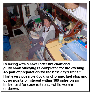
 Liability-waiving disclaimers aside, guidebook authors should be saluted for their courage. They disseminate crucial information that fellow boaters of wildly varying skill levels are relying on. It's a heavy responsibility. No matter how authoritative any guidebook appears to be, we must always remind ourselves that we travel at our own risk reliant on our own wits, current local knowledge and dead reckoning skills. There isn't a guidebook in the world that will take you safely from Point A to Point B if you don't do your own homework. That is why you will find me in the cockpit or salon at the end of each travel day reading up on Chip Ahoy's next potential destination, listing possible anchorages, fuel stops and emergency duck-ins within our target mileage zone on an index card. I mark pertinent pages in various guides with clothespins or paper clips. While underway in windy conditions, the clothespins are handy anchors to keep us on the proper page. In wet weather, large plastic Ziploc bags work well to protect the guides while still affording visibility. When venturing into unknown territory, I make sure that every guidebook, chart and reference manual that may possibly be of use is placed within arm's reach well in advance of departure. Being ready to go means knowing WHERE you are going. There have been many times when Chip Ahoy shoved off earlier than expected due to a change in lock schedules, bridge construction closings, unanticipated rising water, miscalculated falling tides or other waterway situations that require immediate action. I may get caught with half-cooked bacon on the stove or teeth half-brushed, but I will never again be placed in the position of not being sure which channel or which marker delineates our proper path. A wrong turn into two feet of water at the head of the Mississippi River entry cured me of that devil-may-care attitude. Captain Scott and a buddy boat had decided on a spontaneous exit from a restaurant dock before I had even opened the chart-book. Quicker than the Captain could ask "which channel?" Chip Ahoy was firmly stuck in the muck.
Advance planning and reading ahead is especially vital when using guides that are not laid out in the direction in which you are traveling. Fred Myers cleverly circumvents this minor irritation with his "Tenn-Tom Nitty-Gritty CruiseGuide," featuring downbound in one section and upbound in another. The compact size of this classic is another plus. If you hang around the Tenn-Tom long enough, you may even get to meet this guidebook celebrity in person, as our friends Bonnie and Jerry of Blackdog did. He proved to be a delightful dinner companion. Fred has also put out some excellent guides on the Cumberland River and Tennessee River. And like his compadre Skipper Bob, he remains accessible through e-mail for questions, comments and updates that serve to keep his guides as current as possible. Most any guidebook author worth his or her salt appreciates and incorporates suggestions, giving credit where it's due. So don't hesitate to use contact information if you have a hot tip or the opportunity to set the record straight.
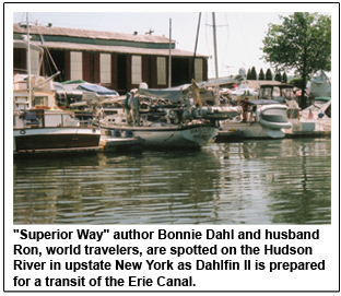
 When it comes to meeting guidebook celebrities, Bonnie Dahl of "Lake Superior Way" tops our list. We are awed, honored and delighted each and every time we share an anchorage or harbor with Bonnie and her delightful and knowledgeable husband Ron. Bonnie autographed our most recent copy of "Superior Way" when we met up with Dahlfin at the Waterford docks at the entry of the Erie Canal. As I have mentioned in previous Cruiser's Notebook features, "Superior Way" is an essential guide and no boater should cruise the greatest of all the Great Lakes without it. Bonnie is not a flowery writer. Her favorite adjective is "interesting." But her lean, spare prose still manages to effectively convey the wondrous natural and man-made attractions found on and around the lake. We particularly value her advice on approaches to harbors and diagrams that indicate potential anchorages. When it comes to meeting guidebook celebrities, Bonnie Dahl of "Lake Superior Way" tops our list. We are awed, honored and delighted each and every time we share an anchorage or harbor with Bonnie and her delightful and knowledgeable husband Ron. Bonnie autographed our most recent copy of "Superior Way" when we met up with Dahlfin at the Waterford docks at the entry of the Erie Canal. As I have mentioned in previous Cruiser's Notebook features, "Superior Way" is an essential guide and no boater should cruise the greatest of all the Great Lakes without it. Bonnie is not a flowery writer. Her favorite adjective is "interesting." But her lean, spare prose still manages to effectively convey the wondrous natural and man-made attractions found on and around the lake. We particularly value her advice on approaches to harbors and diagrams that indicate potential anchorages.
Claiborne S. Young is another mainstay among venerable cruising guide writers. His Gulf and Florida cruising guides abound in nautical bookstores. These weighty tomes contain a lot of historical information and restaurant recommendations that never fail to make me hungry, even if the restaurant no longer exists or has undergone a change in management. We found ourselves using Young's material as more of an adjunct than a primary guide, simply because there is a lot of extraneous info to sift through to get to the meat of practical matters. The sketches of anchoring possibilities proved useful, as did the break-out sections covering harbor/bay/inlet approaches. The best strategy for Young's guides is to read up beforehand and bookmark cogent passages so you are not frantically riffling through a 500-page book at the last minute while the Captain is hollering "do we turn to port or starboard here?" or "where is that sunken wreck?". Constant readers such as myself may enjoy boning up on the history and dining spots once you have stopped somewhere for the evening or a few days. I picked up a lot of trivia with which to regale the Captain as we passed by various sites -he wasn't always a receptive listener, but at least it kept me entertained!
 Our adventures on the water have been significantly aided by Dozier's Waterway Guides. Regularly updated, easy to use and extremely comprehensive, the guides are well worth the price, if only to track the bridges one encounters while transiting America's Great Circle Loop. The grids listing marina amenities and contact numbers are also enormously helpful. Sometimes a hail on the radio won't do it; you need to pick up that cell phone and call 'em direct, especially if you want a price quote on fuel or dockage, which most marinas will not provide over the public airwaves. I do admit a certain prejudice against the Great Lakes version, because some of the material related to going ashore up in my neck of the Superior woods is outdated and too general, as if the contributors merely "visited" here by phone. Perhaps I am just subconsciously peeved because I was not asked to contribute! In any event, I can heartily recommend investing in the Waterway Guides and as we add updated versions we have no reservations about passing along the older versions. They still contain great information that is far better than nothing for the cruisers who can't afford new guidebooks and/or are kidding themselves that they can get along just fine without them. Our adventures on the water have been significantly aided by Dozier's Waterway Guides. Regularly updated, easy to use and extremely comprehensive, the guides are well worth the price, if only to track the bridges one encounters while transiting America's Great Circle Loop. The grids listing marina amenities and contact numbers are also enormously helpful. Sometimes a hail on the radio won't do it; you need to pick up that cell phone and call 'em direct, especially if you want a price quote on fuel or dockage, which most marinas will not provide over the public airwaves. I do admit a certain prejudice against the Great Lakes version, because some of the material related to going ashore up in my neck of the Superior woods is outdated and too general, as if the contributors merely "visited" here by phone. Perhaps I am just subconsciously peeved because I was not asked to contribute! In any event, I can heartily recommend investing in the Waterway Guides and as we add updated versions we have no reservations about passing along the older versions. They still contain great information that is far better than nothing for the cruisers who can't afford new guidebooks and/or are kidding themselves that they can get along just fine without them.
While many guidebooks may be "nice" not "needs," charts are absolutely vital. Do not leave home without them! We have encountered more than one deluded boater for whom ignorance is not bliss. For every delivery captain bragging that he can make it safely and on-time from Tarpon Springs to Corpus Christi navigating by restaurant place-mat, there is an intrepid yet woefully ignorant soul flying blind and paying dearly for his delusions. We were hailed on the Tennessee by a solo sailor who wanted to know "which way to turn" coming around a bend that would have taken him into swampy kayak territory had he continued on his dead-end path. We later heard him hailing a marina at dark and being informed that approach depths were three feet. He had shrugged off our offer to raft him up for a look at our charts and some info on where he could put in for the night with a four-foot draft. He was later stranded in Mobile with a disabled boat and no funds, his dream to sail the waters of the world abandoned. Another character taking a homemade pontoon boat down the Missouri River into the Mississippi told us that charts would just spoil his fun. He bought the charts AFTER he had navigated a particular stretch of water, as a souvenir. All I can say is wow, no wonder his wife and kids refused to travel with him! Also in this clueless category are the monkey-see monkey-do boaters who simply latch onto the flotilla and blindly follow the leader. Heaven help them if they lose the pack and are left to their own devices.
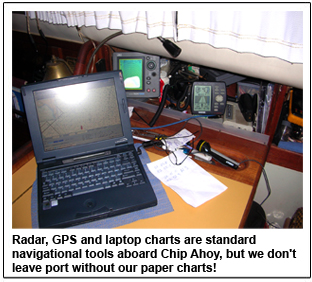 I cannot emphasize enough the need to check ahead in your charts to make sure you have what you need for the next leg of your trip. Dismay and disorientation accompanied two of our most memorable errors in this category, when we found ourselves without paper charts for entering Biscayne Bay and later ran out of "directions" as we headed from the Erie Canal into Lake Erie. In the canal case, rudimentary computer charts were a lifesaver (although I feared a heart attack when the computer blipped into reboot mode at one point and took a few minutes to come back up). As we approached our Biscayne entry a nearby luxury yacht responded to our queries and obligingly radioed waypoints and specific directions. Our first mission upon reaching land was to hunt down the proper charts. For affordability and all-inclusive information, it's hard to beat Jan and Bill Moeller's "Intracoastal Waterway Norfolk to Miami: A Cockpit Cruising Handbook." The mile-by-mile rundown on anchorages, fuel stops, dangerous areas and reference points was particularly suited for us because like this couple we also travel the ICW on a 32-foot cutter. The companion "Intracoastal Waterway Chartbook: Norfolk, Virginia to Miami, Florida," cost considerably less than the 10 individual strip charts we would have needed to purchase for our journey through this area. The chartbook features authentic NOAA maps. Major inlets are also included, but those venturing outside the ICW would also need to invest in the full charts in order to plot a safe course. I cannot emphasize enough the need to check ahead in your charts to make sure you have what you need for the next leg of your trip. Dismay and disorientation accompanied two of our most memorable errors in this category, when we found ourselves without paper charts for entering Biscayne Bay and later ran out of "directions" as we headed from the Erie Canal into Lake Erie. In the canal case, rudimentary computer charts were a lifesaver (although I feared a heart attack when the computer blipped into reboot mode at one point and took a few minutes to come back up). As we approached our Biscayne entry a nearby luxury yacht responded to our queries and obligingly radioed waypoints and specific directions. Our first mission upon reaching land was to hunt down the proper charts. For affordability and all-inclusive information, it's hard to beat Jan and Bill Moeller's "Intracoastal Waterway Norfolk to Miami: A Cockpit Cruising Handbook." The mile-by-mile rundown on anchorages, fuel stops, dangerous areas and reference points was particularly suited for us because like this couple we also travel the ICW on a 32-foot cutter. The companion "Intracoastal Waterway Chartbook: Norfolk, Virginia to Miami, Florida," cost considerably less than the 10 individual strip charts we would have needed to purchase for our journey through this area. The chartbook features authentic NOAA maps. Major inlets are also included, but those venturing outside the ICW would also need to invest in the full charts in order to plot a safe course.
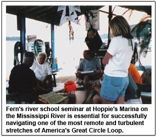
Many of the full heartland river charts do not offer a good bang for the buck, but you'll want to invest anyway because something is better than nothing. Accustomed to excellent Richardson's' charts for Great Lakes sailing, I remember my dismay when I first flipped through the Illinois, Mississippi and Ohio River Corps of Engineers charts. They are very primitive and do not show water depth because levels are always fluctuating. Buoy positions are not fixed due to the fluctuations and, in the case of the "Mighty Mississip," powerful currents often pull the markers out of position.
On our first extended cruise south on America's Great Circle Loop, we purchased a chart/guidebook bundle from Bluewater. We had very sketchy ideas on what to purchase. Bluewater took the guesswork out of the process, packaging up all charts and guides needed from the rivers to the Florida Keys quite nicely for us and efficiently shipping it to our staging marina in Hammond, Indiana. The company's helpful chart/guidebook department can be reached on the internet at blue-waterweb.com or by calling toll-free 1-800-942-2583.
As we traveled, we spoke to other cruisers about which guidebooks they were using as well as internet sources that provided solid updates. There were many times that guidebooks were not in stock at various marinas or quickly sold out when a glob of cruising boats entered port, so we learned to be quick at snatching what we needed as soon as we saw it. At West Marine/Boat US stores, staff obligingly called around to other area stores to locate guidebooks not in stock at that location. During longer stays in one area or another, we were able to order guides and have them shipped directly to the marina where we were staying.
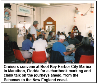
We also were blessed with a number of homemade guides provided by experienced cruisers we met up with along the way. They'd kept track of mileage, inviting anchorages, affordable fuel and marina stops, dining spots and other beneficial information willingly shared at chalk talks, Happy Hours and potlucks along the rivers. The scanner/printer combo that we carry aboard Chip Ahoy was perfect for duplicating these handy notes for our use and to pass along to others. Part of the joy of cruising is sharing knowledge and we are grateful that so many boaters eliminated the guesswork for us as we explored ports new to us.
 Freebies aside, plan on spending a considerable amount of cash on charts and guides. And no matter how discerning you attempt to be, occasionally you'll occasionally acquire a lemon. Take heart and make lemonade! Little nuggets of wisdom may be squeezed from almost any guide that at first glance appears to be completely useless. A small handbook "Cruising Guide to Lake Erie" by FL. Davis - a $7.99 impulse purchase by Capt. Scott -proved to be a godsend when Chip Ahoy and companion sailboat Faith Afloat decided on an unscheduled stop after 30-hour sail from Buffalo, New York. The first harbor we attempted, Fairport/Grand River, was dismal, offering a non-responsive marina that ignored us on the radio and even as we circled in front of it, at which point Faith Afloat fetched up hard on an uncharted shoal ironically situated near the sailing club. Faith Afloat had kedged off the hump by the time we finally got through to the marina on our cell phone. We were informed that the marina did not have diesel fuel but would order a truck if a large quantity would be purchased. Yeah, right. Helloooo - we are in sailboats! Desperately flipping through our only Lake Erie guide, I noted that it listed Mentor Harbor, about five miles west of Fairport, as a privately owned and maintained yacht club. Considering it likely that we would be turned away, we still had to try, using the phone number listed in the guide. In a little under two hours both boats were tied up in a well-sheltered harbor offering non-snobby hospitality, a host of affordable and thoughtful amenities, a nearby grocery store for restocking provisions and ample room for Faith Afloat to load/unload changing crews and accompanying luggage. Freebies aside, plan on spending a considerable amount of cash on charts and guides. And no matter how discerning you attempt to be, occasionally you'll occasionally acquire a lemon. Take heart and make lemonade! Little nuggets of wisdom may be squeezed from almost any guide that at first glance appears to be completely useless. A small handbook "Cruising Guide to Lake Erie" by FL. Davis - a $7.99 impulse purchase by Capt. Scott -proved to be a godsend when Chip Ahoy and companion sailboat Faith Afloat decided on an unscheduled stop after 30-hour sail from Buffalo, New York. The first harbor we attempted, Fairport/Grand River, was dismal, offering a non-responsive marina that ignored us on the radio and even as we circled in front of it, at which point Faith Afloat fetched up hard on an uncharted shoal ironically situated near the sailing club. Faith Afloat had kedged off the hump by the time we finally got through to the marina on our cell phone. We were informed that the marina did not have diesel fuel but would order a truck if a large quantity would be purchased. Yeah, right. Helloooo - we are in sailboats! Desperately flipping through our only Lake Erie guide, I noted that it listed Mentor Harbor, about five miles west of Fairport, as a privately owned and maintained yacht club. Considering it likely that we would be turned away, we still had to try, using the phone number listed in the guide. In a little under two hours both boats were tied up in a well-sheltered harbor offering non-snobby hospitality, a host of affordable and thoughtful amenities, a nearby grocery store for restocking provisions and ample room for Faith Afloat to load/unload changing crews and accompanying luggage.
The investment in "Cruising Guide to the Florida Keys" by Capt. Frank Papy has not yet yielded similar benefits. Poorly edited, badly organized, the frequent misspellings drive this grammar martinet to distraction, as do the confusingly marked mini charts that basically show us all the places Papy went where we can't take our boat. The tide tables with accompanying correction calculations are equally confounding. The pictures are pretty, we get to see what kind of fish Papy caught, but had I had the chance to flip through this mish-mash before Captain Scott was talked into buying it, and it would have been hastily replaced on the shelf.
I am not tossing it, however. It cost $19.95! In fact, the entire sort-and-dis-card project I began turned out to be a wash. We are keeping all of our guidebooks, no matter how lame, if for no other reason than so I can remind the Captain, "We have that one, honey. The pictures are very pretty." Cyndi Perkins and husband Scott, Houghton County Harbormaster, have been sailing Lake Superior for 14 years and have completed two 6,000-mile passages of America's Great Circle Loop aboard their 32-foot DownEaster Chip Ahoy. Opinions expressed by the author are solely hers and not necessarily the opinion of Northern Breezes magazine.
Cyndi Perkins and husband Scott, Houghton County Harbormaster, have been sailing Lake Superior for 14 years and have completed two 6,000-mile passages of America's Great Circle Loop aboard their 32-foot DownEaster Chip Ahoy. Opinions expressed by the author are solely hers and not necessarily the opinion of Northern Breezes magazine.
TOP
|